Friday, May 16, 2008

Help Scientists Find the Mars Polar Lander


In 1999, the Mars Polar Lander (MPL) failed to send a signal to Earth after it was supposed to have landed on Mars, leading scientists and engineers to believe it most likely crashed. However, scientists still don't know exactly what happened to MPL, nor where exactly it crashed on the surface of Mars. In the wake of MPL's failure, the University of Arizona proposed the Phoenix Mars Lander. On May 25th, Phoenix will be landing in the high northern latitudes of Mars in an attempt to accomplish many of the same science goals as the doomed MPL.

Recently, the Mars Reconnaissance Orbiter's High Resolution Imaging Science Experiment (HiRISE), released 18 images of the supposed MPL landing/crash site. They are asking for the public's help in locating the doomed MPL lander. Each image is HUGE, approximately 1.6 billion pixels. "If your computer screen is 1000 by 1000, that means you need 1600 screen shots to view one image," says Alfred McEwen, who leads the HiRISE team. If you'd like to learn more and participate, check out these sites: New Scientist and HiRISE blog.

To learn more about the Phoenix Mars Lander and the events surrounding its may 25th landing, click here.

Friday, May 2, 2008

Would you like to go to the Moon?

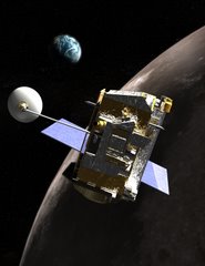
At this time, NASA is not sending people there, just LRO and LCROSS. But you can send a little part of yourself there... your name.

The Send Your Name to the Moon Web site enables everyone to participate in NASA's lunar adventure and place their names in orbit around the Moon for years to come. Participants can submit their information at http://lro.jhuapl.edu/NameToMoon/, print a certificate and have their name entered into a database. The database will be placed on a microchip that will be integrated onto the LRO spacecraft. The deadline for submitting names is June 27, 2008.


While you're online, check out the new videos on the LRO mission page: http://www.nasa.gov/mission_pages/LRO/main/index.html

Join us at the Moon!!

Monday, April 28, 2008

Geology 101 from the Cascades!

I’m on the road (again) this week. This time, I’m in Portland, Oregon. I flew out a couple of days early to get some vacation time. While the weather hasn’t exactly been cooperating, the geology certainly has!

I did some driving today through the Columbia River Gorge and around Mount Hood, and I wanted to share with you some really cool geology from the area.

First of all, I should probably provide some background. The Columbia River Gorge has been (after all, it is still being formed) formed through a series of events that have occurred to give it its current configuration. This configuration was especially important for the Oregon Trail, but that’s a whole different post.

Anyway, between 17 and 12 million years ago, the Columbia River plateau formed from a series of flood basalt flows. These flows were unlike anything we see today. The area covered by these flows (similar flows occurred in the Deccan Traps) includes portions of today’s Washington, Oregon, and Idaho - to the tune of 164,000 square kilometers. As these basalt flows (think the same kind of rock found in the Hawai’ian islands) cooled, the rocks cracked, forming columnar basalts. I was able to see these columnar basalts when I visited several waterfalls along the gorge.

Since then, the area witnessed the birth of the Cascade Mountain range. Unlike other mountain ranges such as the Sierra Nevadas or the Appalachian Mountains, the Cascade Range consists of a series of volcanoes. Among these volcanoes are the infamous Mount St. Helens, Mount Rainier, and Mount Hood. Because of their proximity to subducting tectonic plates, these volcanoes erupt with a siliceous magma that is very viscous (hard to flow). These rocks form a special kind of volcanic rock called andesite, and can be seen not only throughout the Cascades, but also the Andes (hence the name - ande-site). Today, as I circled around Mount Hood, I came across some of those andesites.

At the same time the Cascades were forming, the entire area has undergone a tectonic uplift, raising the continental crust. The action from the mighty Columbia River has served to form what is now known as the Columbia River Gorge. It’s the same kind of process that has helped form the Grand Canyon. As the continental crust raises, the river’s force has scoured out the landscape as it makes its way to the ocean. Because the area rose so rapidly (in geologic times, mind you), the river gouged out a narrow passageway instead of meandering its way across the land. To picture the difference between the two processes, think of a comparison between the Grand Canyon and the Mississippi River delta. One is deep and narrow, one is wide and flat.

Well folks, there you have it. Geology 101 from the Cascades. I hope the next time you step out your front door, think of all the things that had to take place in the past to shape the land to its current configuration!

Friday, April 25, 2008

Atmosphere: Change is in the Air

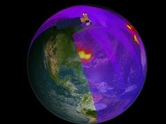
Several years ago I had the opportunity to work with the Smithsonian Institution Natural History Museum on an exhibit about the Earth's atmosphere. The EOS Aura education and outreach program funded the creation of the "Atmosphere: Change is in the Air" exhibit as part of the Smithsonian's "Forces of Change" program. I work at NASA Goddard Space Flight Center, a very cool (in a geeky sort of way) place-but when I got my temporary badge for the Natural History Museum I felt like a little kid... my pass to go behind the scenes at Natural History!! I worked with scientists, exhibit developers and graphic designers and learned how I little I knew about story telling through museum exhibits. The final product included large panels, interactive kiosks, movies and still images from satellites and my favorite component- the Oxygen Theater (you can find this video and other images and stills in the Media Library of the Forces of Change webiste)

Here is more information on the "Atmosphere: Change is in the Air" website:

Explore Earth’s changing atmosphere. Discover how our ever-changing atmosphere transports substances around the globe, protects life from destruction, and supports millions of chemical reactions. Find out how scientists track changes in the atmosphere and why they matter to everything that breathes.

This web site incorporates images and information from the Atmosphere: Change is in the Air exhibition developed by the Smithsonian’s National Museum of Natural History, which was on display at the Museum through November 2006. The exhibition explores the chemistry, properties, and significance of earth’s atmosphere—the invisible envelope that surrounds and affects us all.