Tuesday, August 21, 2007

Twittering from the NASA IPY Meeting II


We are back at Goddard today for day 2 of the NASA IPY education and outreach meeting...


Polar Palooza!! http://tinyurl.com/yvjd8e

Check here to see if NASA IPY's Polar Palooza is coming to a place near you http://tinyurl.com/237jcb

the Polar Palooza tagline is "Stories from a changing planet" There will be all sorts of folks who will be part of the tour

oooo! LRO is featured in Polar Palooza when it comes to St Louis Oct 2008

Next talk is on "Exploring Local Landscapes" using Satellite images. The focus is on urban areas

They will use GIS, GPS and remote sensing to connect students to studies in polar regions. The program is out of the University of Toledo

They will use Landsat images available through America View http://www.americaview.org/

Exploring Landscapes student present their research projects at regional science meetings.prizes are "trophies as big as sports trophies!"

Next IPY project collaboration of Windows to the Universe http://www.windows.ucar.edu/ and National Earth Science Teachers Association

National Earth Science Teachers Association National Earth Science Teachers Association http://www.nestanet.org/php

Checkout IPY project Postcards from the Field http://www.windows.ucar.edu=/people/postcards/penguin_post.html

US Satellite Laboratory IPY collaboration . They have a number of cool projects http://www.us-satellite.net/

Most of US Satellite's projecst are for schools ....Signals of Spring, 3-D view include teacher training and classroom support

My NASA Data has IPY related data sets http://mynasadata.larc.nasa.gov


Monday, August 20, 2007

Twittering from the NASA IPY Meeting

I am currently sitting in the NASA International Polar Year education and public outreach meeting. During the meeting I am twittering the meeting highlights....here are my tweets from the from the first session.

in the IPY meeting! Jim Garvin is talking about polar regions on the Moon and Mars http://tinyurl.com/2eqhz9


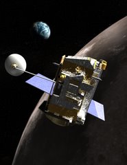
Wow! Jim has the new LRO spacecraft visualization! Really cool (in a geeky sort of way) http://lunar.gsfc.nasa.gov

now Jim is talking about Mars polar regions here's Jim http://tinyurl.com/28orru

I want Jim Garvin's Moon and Mars visualizations! We are meeting in GSFC's Science Visualization Studio http://svs.gsfc.nasa.gov/

Geeking out at high res images from MRO http://mars.jpl.nasa.gov/mro/ of the north polar region of Mars

now Jim is talking about Phoenix mission. It launched 2 weeks ago. Check out the video http://phoenix.lpl.arizona.edu/videos.php


Check out the NASA and IPY Video
http://ipy.nasa.gov/multimedia/m000000/m000000/m000015/index.html

NASA Antarctic researcher Bob Bindschadler is talking about LIMA ..Landsat Image Mosaic of Antarctica http://lima.usgs.gov/

LIMA: Faces of Antarctica is the education project that will introduce people to Antarctica. Website launches 10/07 http://lima.nasa.gov/

Now the guy from Earth & Sky, Ryan Britton http://www.earthsky.org/

Earth & Sky do radio shows on NASA polar science in english and spanish and podcasts over the next two years. Also social networks: MySpace


Lots of good discussions at lunch ... Now back to Twitter!

Now the GLOBE presentation http://www.globe.gov with a focus on the earth systems science projects

GLOBE Seasons and Biomes http://tinyurl.com/yr7zan

Bob Myers is talking about ESSEA http://essea.strategies.org/ Earth Systems Science Education Alliance online courses for science teachers

The ESSEA courses evolved from just online to combination of online and face-to-face. 3 courses K-4, 5-8, 9-12

Over 1700 preservice and inservice teachers were trained between 2002 and 2005 through ESSEA semester long courses

NASA IPY ESSEA project is to update K-4 course with polar themes and add some polar content to middle and high school courses

Teachers interested in taking an ESSEA course check out current course offerings http://essea.strategies.org/participants/offerings.aspx

DEW Digital Earth Watch...lead by museum of science in Boston with 6 partners uses plant health to monitor the environment

Now one of our projects Sharing IPY to Librarians and Afters School programs

This IPY project builds on "Explore fun with Science" http://www.lpi.usra.edu/education/explore/


Thursday, August 9, 2007

Robotic Design Challenge

During the week-long Girl Scouts USA core trainers workshop at NASA's Johnson Space Center participants learned about the engineering and science related to the robotic exploration of the Moon and Mars. They did a variety of hands on activities, toured labs and heard from scientists and engineers who are part of robotic exploration programs. They received Lego Robotic Kits, a Robotic Arm Trainer and a hand held Alta Spectrometer. Their final activity or "capstone experience", the Robotic Design Challenge, was to propose, design and build a robotic mission to the Moon or Mars. The mission had to address one or more of NASA's science and exploration objectives associated with the return of humans to the Moon and on to Mars. Here is the mission proposal and design from one of our teams

Robotic Exploration Design Challenge
Mission Plan/Proposal

Heide Basinger, Girl Scouts of the Huron Valley Council
Carol Chu, Washington Rock Girl Scout Council
Terry Gryting, Girl Scouts Susitna Council
Faye Van Dyke, Angeles Girl Scout Council


LALUNA MISSION


Chandrayaan-1 will launch in March 2008. Two months into this mission by the Indian Space Research Organization (ISRO), the Moon Mineralogy Mapper (M3) will have returned images showing the mineral composition on the entire surface of the Moon. Our robotics exploration mission (LaLuna) will be based on their findings about the location of the mineral ilmenite, a mineral made up of iron titanium oxide. The mineral ilmenite will be critical to a sustained human presence on the Moon because it can be heated to release oxygen.

LaLuna will then determine the depth of the ilmenite deposit. Determining the depth of the ilmenite will aid in determining the volume, and therefore the quantities of oxygen that might be produced. Decisions could then be made about our ability to produce enough oxygen to sustain human life.

MISSION PLAN:

The spacecraft used to carry out the LaLuna Mission will cost $235 Million, with a mass requirement of 81 and requiring 30 units of power. After landing on the surface of the Moon, our robotic mission will use a spectrometer to first confirm the presence of ilmenite, and then will attempt to drill 4 meters into the Moon’s surface. Extracting a core sample, the spectrometer will verify the presence of ilmenite at various points along the core sample to determine the depth of the deposit. The robotic arm can rotate to drill in multiple nearby locations at the landing site.

PROCESS:

The LaLuna Mission Team considered some important questions that need to be answered to help determine the viability of sustaining a human presence on the moon. It was determined that providing another piece of the puzzle, ability to produce sufficient oxygen, would work toward this end.

Using information gained during this week of workshop sessions and tours, we discussed the science, which led to a list of the instruments needed. A design was sketched and changed multiple times as the discussion continued and ideas evolved, and better methods were discovered and ideas were discarded. The Team also considered the cost and energy and mass requirements.

Materials were gathered to construct a model using the design. A model was built which fit the size and materials specifications.
The LaLuna team during their presentation to the review panel.


Friday, August 3, 2007

Seasons and Biomes at the GLOBE Annual Meeting

This morning I did a workshop "Quantifying Change with Landsat" for the Seasons and Biomes project during the GLOBE annual conference in San Antonio, TX. We had forty participants from the US, France, Russia, Lebanon, UK, Argentina, Thailand, Mexico and more. While I have quite a bit of experience with Landsat, I am new to Seasons and Biomes and the quantifying change exercise. Elena Sparrow, the principle investigator of Seasons and Biomes gave an overview of the project.

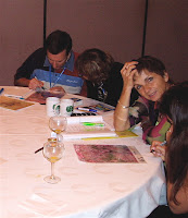
We continued with an overview of how NASA uses satellites to study the Earth and focused on the Earth System, the interaction of land, water, air and life. For our engagement activity we did the landform quiz; projecting different landsat images and having participants at each table try to identify the landforms and setting of each satellite image. Here are some of the images that we used in the quiz. All are from the Landsat family of satellites that fly 700 km above the earth's surface.

What do you see? Do you know where these places are?

We had quite a lively discussion about the Landsat images and some very interesting interpretations. By the time we finished this activity our participants were ready to learn more about the how and why of Landsat. And yes, I did give them the answers!